Are you interested in starting a Drone Program for your company?
SITECH Michigan has the right solution for you!
We have multiple options for flying and processing
For information regarding Drones,
Please Contact: James Kahn (248) 320-7606
email James
Trimble Stratus
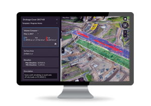
Trimble Stratus software helps civil contractors use drones to map, measure and share accurate information about their worksites and assets. With Stratus, you can make quicker decisions, avoid mistakes, and grow profits by always having the right information on hand.
Trimble Business Center
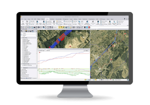 Powerful tools help you create accurate, integrated 3D models for sites and highways quickly and easily. Make better decisions, decrease costly mistakes, and increase efficiency in the office and on the job site.
LEARN MORE
DJI Mavic 3 Enterprise
 The Mavic 3 Enterprise is a commercial-grade, survey-focused UAV that’s perfect for your typical earthworks site. It’s highly suitable for precision site mapping in the civil construction, aggregates, mining, and waste management industries.
DJI Phantom 4 RTK
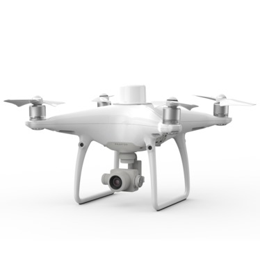 The Phantom 4 RTK is DJI’s first survey-focused UAV. The real-time kinematic (RTK) unit on the drone itself allows photos to be geotagged with survey-grade accuracy.
DJI Matrice 350 RTK
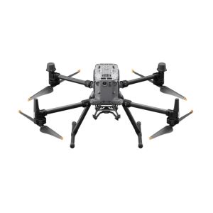 Survey large, complex job sites with ease and accuracy
The M350 is built for tough conditions and extreme temperatures (-4 to 122°F / -20 to 50°C) with a self-heating battery and weather sealant that protects it from rain, dust, and even winds up to 39 ft/second. Paired with Propeller PPK, tough conditions are no match for delivering survey-grade accuracy, every time.
Map & Measure Large, Complex Worksites with the DJI Matrice 350 RTK and Zenmuse P1 and/or L1 bundle
Bundled with the Zenmuse P1 sensor, the Matrice 350 provides a powerhouse experience for the not-so-average job site. When you need a drone that’s tough enough to handle up to 55 minutes in flight time and up to three payloads simultaneously, the M350 may be the right option.
The Matrice 350 is the SITECH Michigan solution for aerial LiDAR surveys with the L1 Sensor.
Wingtra One GEN II
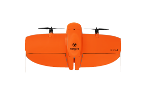 SITECH Michigan Is Proud To Announce That We Are Now An Authorized Wingtra Dealer!
The WingtraOne vertical take-off and landing (VTOL) drone allows you to conduct both small- and large-scale drone surveys with unmatched data quality—at a fraction of the time and cost.
SITECH Drone Services
Do you want the benefits of a Drone Program, but don't want to buy a drone?
We will fly for you!
Contact us for options.

